Right now
6 °C
Clear
- Feels like
- 2°C
- Humidity
- 90%
- Wind
- 16 km/h gentle wind
- Chance of rain today
- 💧 2%
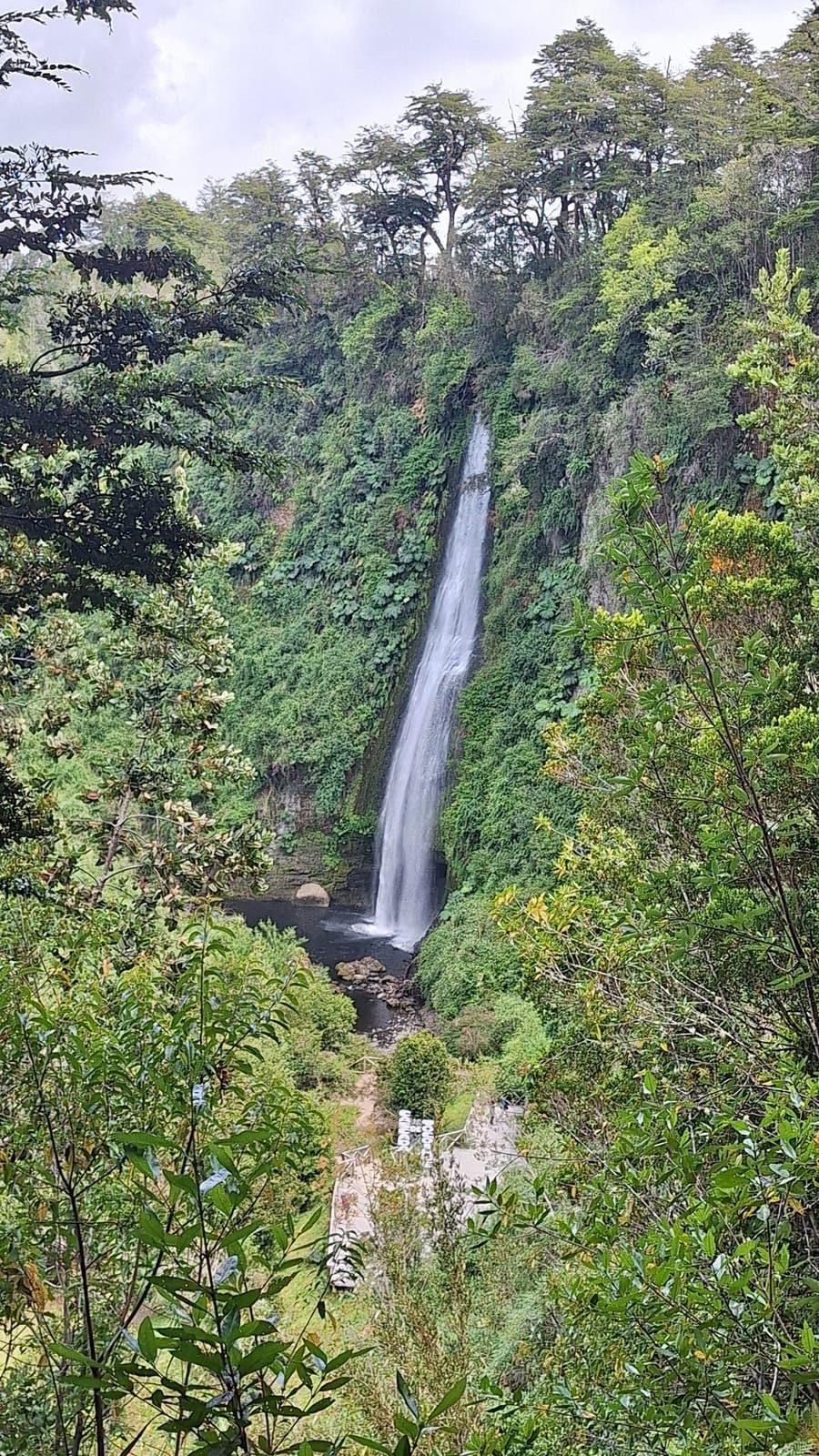
Set on ancestral Huilliche territory a short drive from Dalcahue, this waterfall combines an easy forest walk, basalt geology and cultural interpretation in one of Chiloe's most rewarding nature visits.
Today's Planning Note
Weather
Weather shifts quickly on Chiloe; showers are common, so waterproof outerwear and grippy shoes are recommended.
Road Access
The gravel road to Tocoihue is usually passable, but after heavy rain it is wise to confirm same-day conditions in Dalcahue.
Trail Length
About 600 m one way
Difficulty
Easy, family-friendly
Visit Time
1.5 to 2 hours
Welcome to the Cascadas de Tocoihue, widely recognized as the central Tocoihue. Located in the heart of Dalcahue, Los Lagos Region, Chile, this destination serves as a primary hub for travelers visiting the Isla Grande de Chiloé.
Place profile
The Cascadas de Tocoihue are located in the rural sector of Tocoihue, Dalcahue commune, Los Lagos Region, Chile, about 20 km from town via the U-48 road. The geographic hierarchy of the place is Cascadas de Tocoihue → Dalcahue → Los Lagos → Chile.
📍 View route on Google MapsCascadas de Tocoihue
When visiting the Cascadas de Tocoihue, travelers can easily explore surrounding historical landmarks and points of interest, including the Dalcahue Church and Chiloé National Park.
An 18th-century wooden church, part of the Churches of Chiloé inscribed as a UNESCO World Heritage Site.
Native forest, dunes and Pacific coastline, a short drive towards the west of the island.
Colourful houses on stilts along the waterfront of Castro, about 20 minutes from Dalcahue.
The name Tocoihue points to the Huilliche Mapuche root of Chiloé's territory, and the river that names the waterfalls rises in the hills of the Dalcahue interior. For centuries it was part of daily life for Huilliche communities, until it became one of the most valued nature outings in Chiloé.
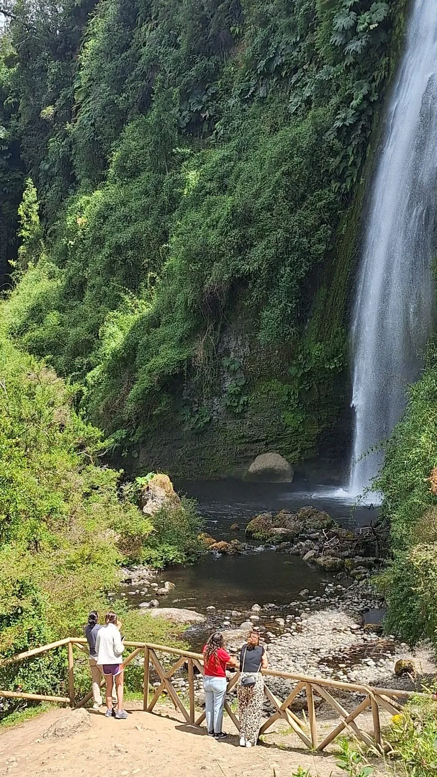
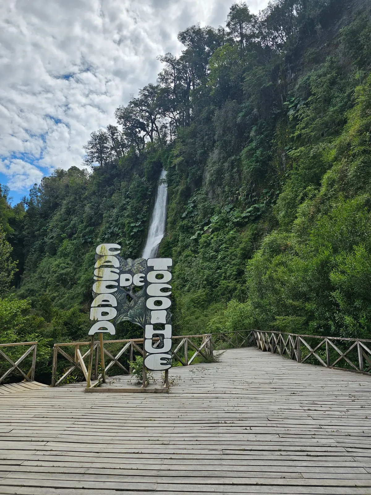
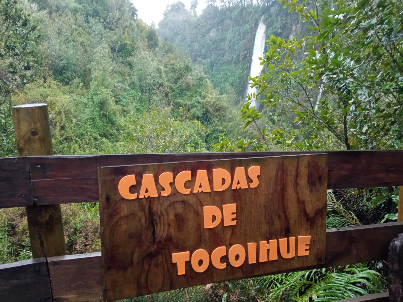
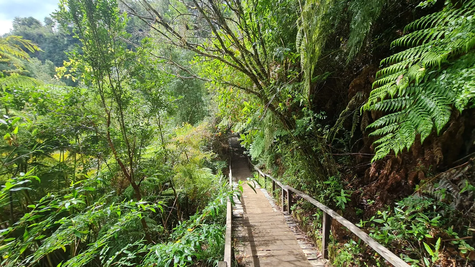
The Cascadas de Tocoihue are a series of waterfalls on the Tocoihue River, in the rural sector of the Dalcahue commune on the Isla Grande de Chiloé. The trail passes through a native forest of coihue, ulmo and tique trees to a main drop that falls down a wall of volcanic rock. The site is part of a public-use nature reserve and lies within ancestral Huilliche territory, inside the ecoregion of Chiloé's temperate rainforests. It is one of the best-rated nature outings near Dalcahue and a key stop on Chiloé's Route of the Waterfalls.
The waterfalls lie within a public-use nature reserve in the rural sector of the Dalcahue commune, on the Isla Grande de Chiloé, Los Lagos Region. The site protects a stretch of the Tocoihue River and its surrounding native forest, and is managed as a conservation property with visitor access. The surroundings are part of ancestral Huilliche territory and of the ecoregion of Chiloé's temperate rainforests, noted for their rich diversity of lichens, ferns and birds.
Non-profit & Conservation
Visitor income helps maintain trails and viewpoints, care for the river corridor and support local educational and interpretive work connected with the Huilliche landscape.
Trail Length
About 600 m one way
Difficulty
Easy / family-friendly
Visit Duration
1.5 to 2 hours
Hours and access
The property is a private nature reserve that opens during daylight. Fixed hours apply in high season and can change with weather, river flow or trail maintenance: always confirm before travelling.
Because the reserve depends on the weather, access can close without notice in heavy rain, strong wind or when the river rises.
Indicative prices reported by recent visitors: they may change and are best confirmed on arrival. Carry cash in small notes, as the signal needed for card payments is intermittent in this rural area.
December – March (summer)
High season, fixed hours and the busiest period. Arrive before 11:00 to avoid congestion on the gravel road.
April – May (autumn)
Fewer visitors and the forest is still green. Rain begins to increase and the trail turns slippery.
June – August (winter)
The wettest month: the falls run at their most powerful, but there is mud, less daylight and occasional storm closures.
September – November (spring)
The most comfortable trail, more daylight and good visibility, with the flow starting to drop. The most balanced season for walking.
The visit is always on foot along a forest trail; it is not a drive-through or a car circuit.
Because this is a private property whose access depends on the weather, the safest way to confirm opening, exact hours and current prices is to call or message the published number on WhatsApp.
If you are coming from far away, confirm on the day itself: temporary closures for wind or heavy rain are common.
Directions
The falls are about 20 km inland from Dalcahue along route U-48, in the rural sector of Tocoihue. The final kilometres are gravel with no continuous signage, so set off with the map already downloaded.
Start in central Dalcahue
From the centre of Dalcahue, around the market and the waterfront, take the road inland towards the Tocoihue sector (route U-48).
Stay on the main road
Keep to the main road for about 20 km. You will pass rural properties, fences and fields; there are no shops or fuel stations on this stretch.
Leave the asphalt behind
On the last section the road turns to gravel. Slow down, especially in the rain: the surface gets slippery and there are narrow bends.
Find the signposted turn
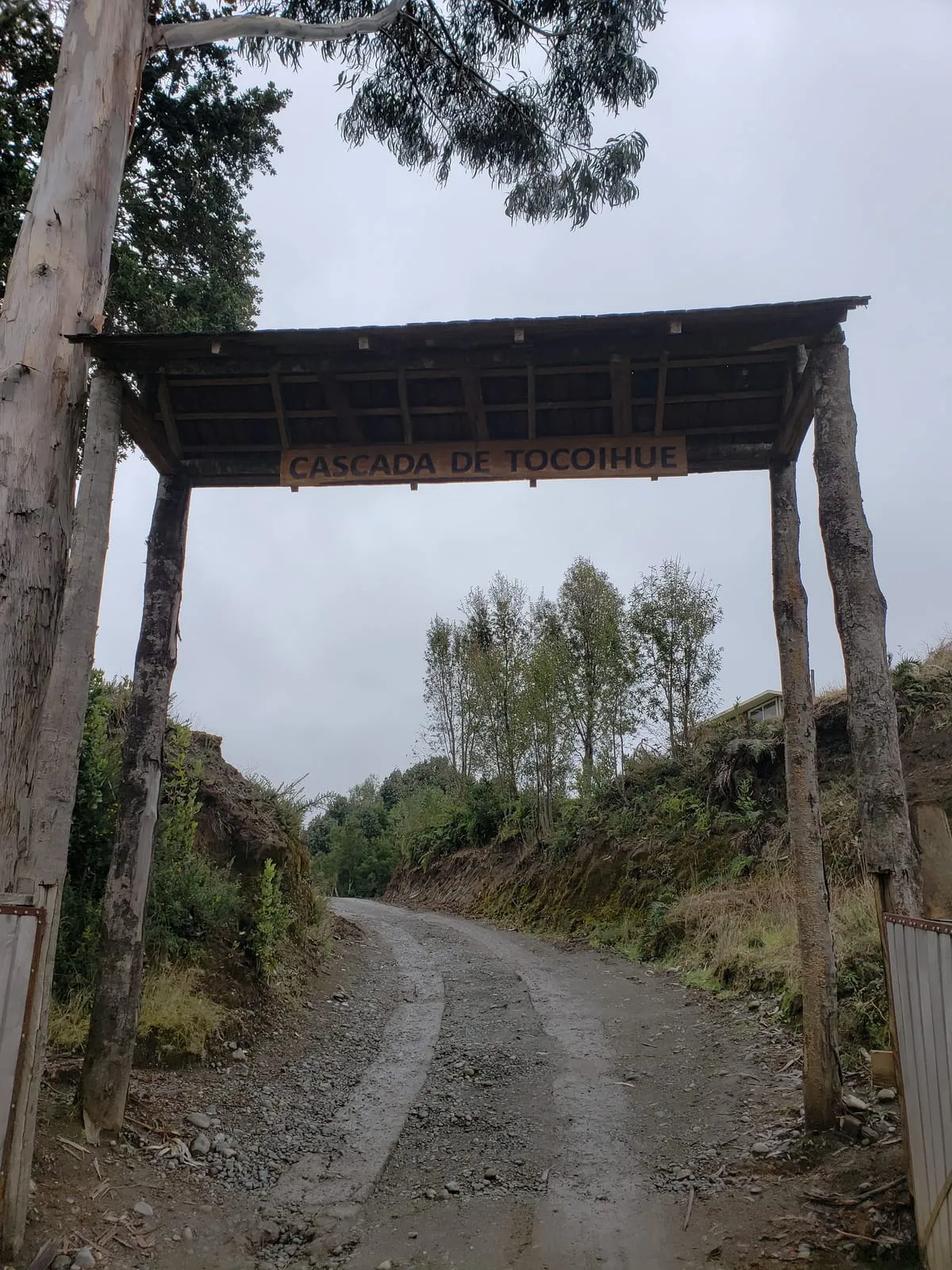
The entrance is announced with wooden signs. If you reach a fork with no signage, back up a few metres: the turn is easy to drive past.
Park at the entrance
Parking sits beside the access on an unpaved surface. From there the visit continues on foot along the forest trail only.
Estimated time: about 30 minutes from central Dalcahue by car, longer when the road is wet. There is no regular public transport to the entrance.
If your map app fails to load, type the Plus Code MHW6+5W: it works even when mobile coverage is intermittent.
The map shows the rural area between Dalcahue and the entrance. Download the area for offline use before leaving: signal is patchy on the gravel road.
Local weather
The rural sector of Tocoihue is one of the wettest corners of Chiloé: weather turns quickly and the flow of the falls depends on recent rain. We translate the forecast into decisions you can act on.
⚠️ Safety notices
Right now
6 °C
Clear
Observed at 02:30
Advice generated from today's forecast. Only the points that apply are shown.
Notices are derived from forecast data and are not an official weather warning. In extreme conditions, always follow the instructions of on-site staff.
Today
10° / 5°
💧 2%
Sat
9° / 3°
💧 0%
Sun
11° / 6°
💧 0%
Mon
12° / 6°
💧 2%
Tue
11° / 7°
💧 13%
Wed
14° / 8°
💧 76%
Thu
12° / 7°
💧 34%
Rain probabilities are indicative only: in Chiloé a day can go from drizzle to clear skies within a few hours.
Weather data: Open-Meteo
From the international flight to the final stretch of gravel through rural Dalcahue, here are the most common ways to get to the Cascadas de Tocoihue on the Isla Grande de Chiloé.
If you are coming from outside Chiloé, the usual pattern is to fly or take a bus to Puerto Montt, cross the Chacao Channel onto the island, then continue by road to Dalcahue. From there the waterfalls are about 20 km along a rural road. For most visitors the final stretch is by own car, taxi or tour, because public transport does not reach the reserve gate.
Option 01
The nearest island airport is Mocopulli (MHC), near Castro. From the mainland, El Tepual Airport (PMC) in Puerto Montt is the main option.
Option 02
This is the cheapest way to reach Dalcahue. Buses run frequently from Puerto Montt and from Castro to Dalcahue.
Option 03
To enter Chiloé from the mainland you cross the Chacao Channel. Today the crossing is made by the Chacao Bridge, linking Pargua with the island.
Option 04
From Dalcahue or Castro, a taxi or private tour is the most comfortable way to cover the ~20 km of rural road to the reserve.
Option 05
Driving gives you freedom to explore Chiloé. From Puerto Montt take Route 5 to Pargua, cross the Chacao Channel and continue to Dalcahue, then take Route U-48 towards Tocoihue.
Option 06
From Dalcahue, cyclists can tackle the rural road, though the ~20 km of gravel demands good fitness and a suitable bike.
Typical Entry Fee
Usually CLP 1,000 - 3,000
Amounts may vary by season and site management; cash is often the safest option.
Visitor logistics
Before setting out it helps to know what actually exists on site and what you need to sort out in Dalcahue or Castro. Here is what to expect, by type of service, in the rural sector of Tocoihue.
Neutral listing. We are an independent, non-profit information project. We describe types of service only and do not endorse, sponsor or hold any agreement with specific businesses. Confirm opening hours, prices and availability on site.
There are basic toilets at the reception area of the reserve, but none along the trail. These are rustic facilities, typical of a rural property, and heavily used in high season.
The water in the river and streams is untreated and not safe to drink without purification. There are no refill points along the rural road, so carry water from Dalcahue.
Parking is at the entrance to the property on an unpaved, unmarked surface. Capacity is limited, especially in summer and on long weekends.
There is no restaurant or café within the walking route. Food in the area is of the local kind and concentrated in Dalcahue and Castro: small eateries, cafés, bakeries, markets and Chiloé cuisine restaurants.
There is no formal tourist accommodation in the rural sector of Tocoihue. Options are of the cabin, guesthouse, campsite and hotel type, concentrated in Dalcahue, Castro and neighbouring villages.
To stock up you need to pass through Dalcahue or Castro: mid-sized supermarkets, neighbourhood stores, markets and specialist shops. There is no commerce at all on the rural road.
Fuel stations are in Dalcahue and Castro, not in the rural sector. The island’s EV charging network is still sparse and concentrated in the communal centres.
ATMs are in Dalcahue and Castro. In rural areas and at nature reserve entrances, payment is usually in cash, and the signal needed for card payments can fail.
Mobile coverage in the rural sector of Tocoihue is partial and intermittent, and it degrades through forest and ravine sections. There is no public wifi on the trail or at the viewpoint.
Because of the distance and the gravel road, emergency services take a long time to arrive. In an emergency, call the national numbers and give your location using coordinates or a Plus Code.
The route is not adapted: the access road is gravel and the forest trail has roots, slopes and narrow sections. The reception area is the flattest part of the property.
Guided excursion and tourist transfer services operate from Castro and Dalcahue. They are booked through agencies and local operators, not inside the reserve.
Indicative distances and times calculated from the reserve entrance along rural roads. They vary with the state of the gravel, rainfall and the season.
Service information is reviewed periodically, but in rural areas availability changes with the season. We recommend confirming opening hours and fees at the reserve itself or with the Municipality of Dalcahue before travelling.
The name Tocoihue points to the Huilliche Mapuche root of Chiloé's territory, and the river that names the waterfalls rises in the hills of the Dalcahue interior. For centuries this watercourse was part of daily life for the Huilliche communities of Chiloé, who knew the forest and its springs long before the arrival of the colonial haciendas. Over time the main drop became a local recreation spot, and already in the 20th century Dalcahue families began visiting it as a nature outing. Today the property is organised as a public-access nature reserve, caring for the riverbed and the native forest.
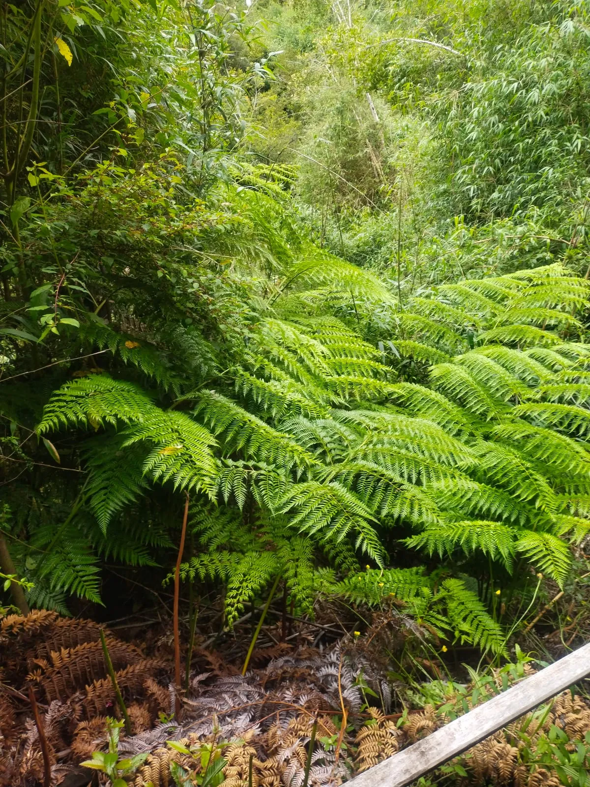
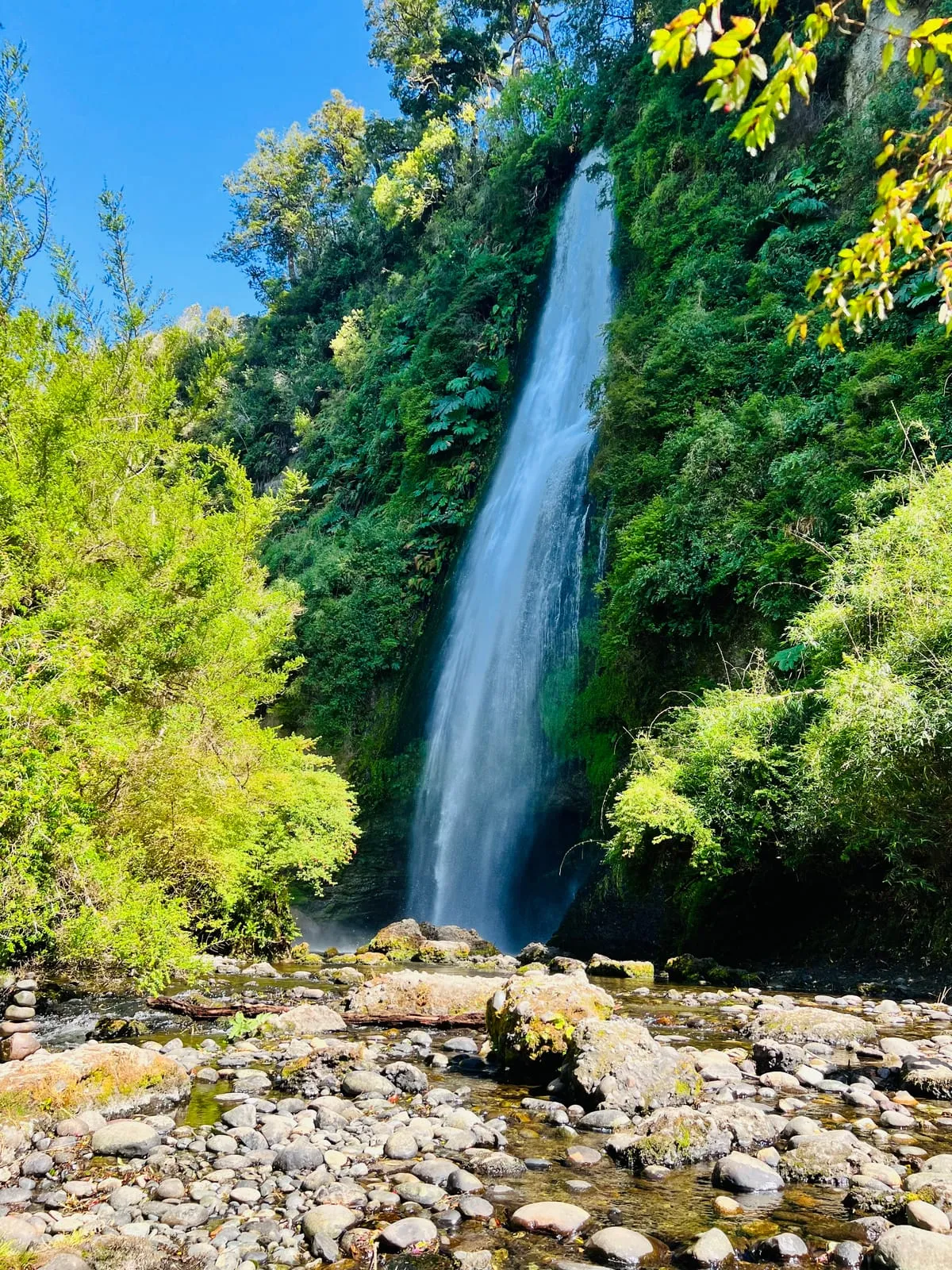
Chiloé is a volcanic island, and the wall the water falls down is basalt rock shaped by the river over thousands of years. The forest around the falls is temperate native woodland: coihue, ulmo, tique and canelo, with a dense understory of ferns and moss that holds the moisture of the rainy climate. This combination — clean water, volcanic rock and cold rainforest — is exactly what makes the place unique, and explains why the water stays clear and the setting stays so green.
In the Mapuche worldview, every river, forest and stone has its own spirit, the ngen. The Huilliche elders of Chiloé spoke of the ngen of the water that lives in the springs and the falls, and taught people to approach the river with respect, never polluting or disturbing it. They also tell that on foggy mornings the sound of the falls seems like an ancient voice reminding the listener that water is life. Whether fable or teaching, the legend invites you to visit the waterfalls as one enters a sacred place, not merely a viewpoint.
Today the Cascadas de Tocoihue are one of the most loved nature outings near Dalcahue and a landmark of Chiloé's Route of the Waterfalls. Far from the bustle of big cities, they offer a close and accessible experience of the island's temperate forest, with the added value of standing on Huilliche territory. For anyone touring Chiloé in search of its nature and its stories, Tocoihue is an almost mandatory stop.
The waterfall is simply the point where the Tocoihue River drops over a step in the terrain; it is not a standalone phenomenon. Upstream there is a whole catchment that captures rainfall, stores it in the soil and the forest, and releases it gradually to the channel. That is why the flow varies so much: after several days of rain the water comes down turbid and powerful, while in dry spells the fall splits into threads and exposes the rock below. Understanding that relationship is the key to choosing when to visit.
Chiloé's temperate rainforest is one of the ecoregions with the highest proportion of endemic species in South America. Around the channel live tree ferns, mosses and lichens that depend on constantly humid air, alongside river-edge birds and amphibians that need clean, cold water to breed. That dependence explains why protecting the bank and the forest upstream also protects the waterfall itself: without a healthy catchment, there is no clear fall.
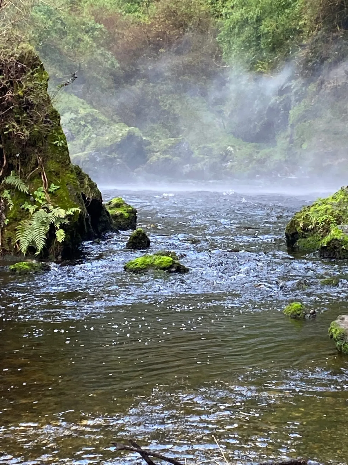
The flow depends directly on local rainfall. Between May and August the fall carries the most energy and the forest green is at its deepest, though the ground turns muddy and the days are short. In spring and summer the trail is more comfortable and daylight lasts longer, with somewhat lower but equally clear water. Whatever the season, arriving early means better light, fewer visitors and a better chance of seeing low mist over the falls.
Species Field Notes
The waterfall is only one visible expression of a larger temperate rainforest system shaped by trees, ferns, mosses and wetland fauna.
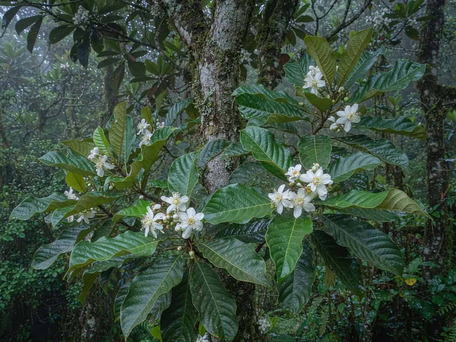
Eucryphia cordifolia
A characteristic evergreen tree of southern Chilean rainforests, often associated with mossy bark and humid forest structure.
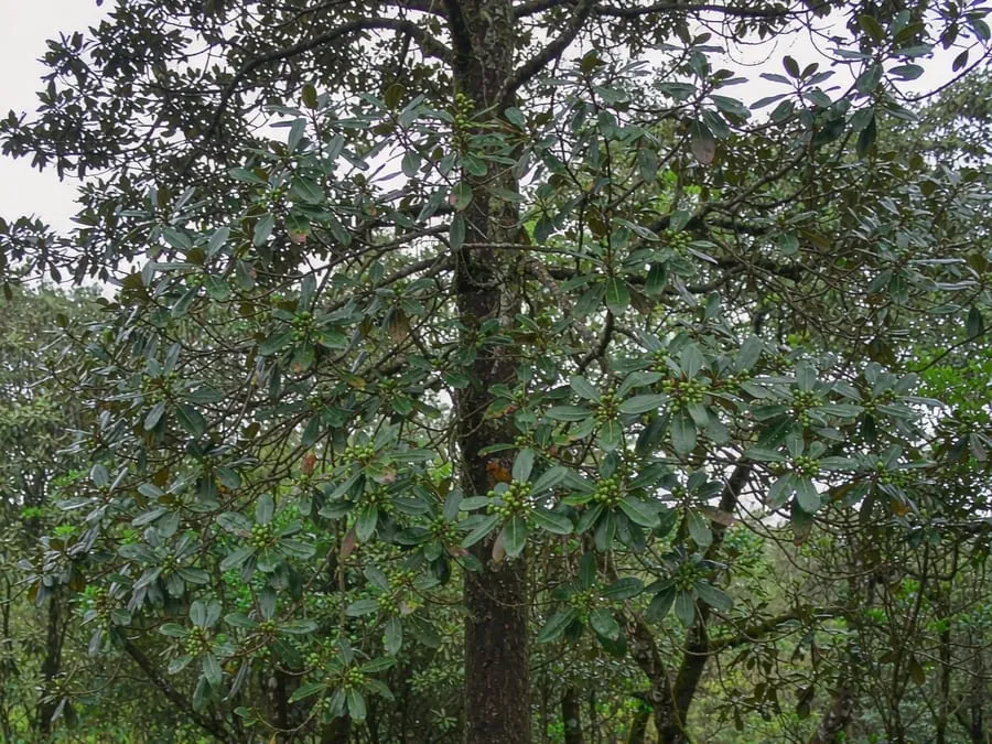
Nothofagus dombeyi
A dominant canopy tree that helps stabilise slopes and shade the watershed.
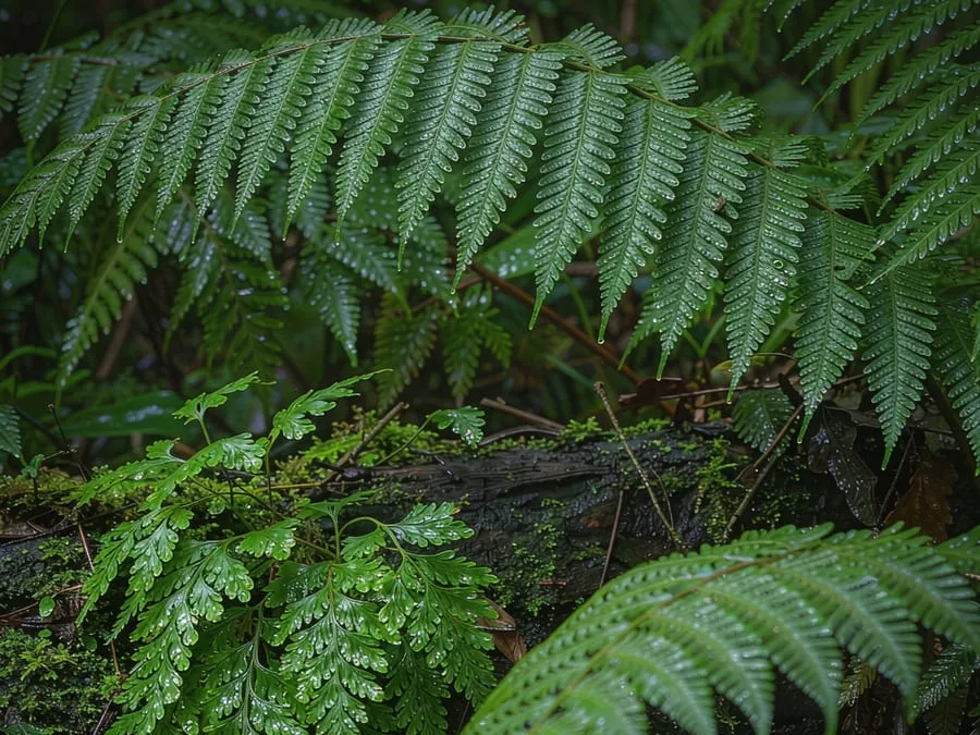
Blechnum spp. / Hymenophyllum spp.
Ferns and filmy ferns indicate persistent humidity and a well-preserved forest understory.
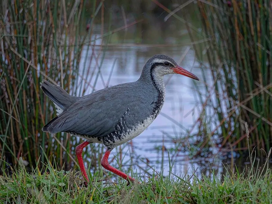
Pardirallus sanguinolentus
Wetland birds in the valley remind visitors that the waterfall is part of a broader hydrological ecosystem.
Historical background
The waterfall has no founding date: it is a geographic feature that predates any written record. To understand it you have to look at the long history of the Chiloé archipelago and of the Huilliche people who inhabited this territory.
Before the 16th century
Chiloé was home to Huilliche and Chono communities organised in chiefdoms that depended on the forest, fishing and shellfish gathering. The rivers of the Dalcahue interior — including the one that forms the falls — were part of that everyday territory.
1540 – 1600
Spanish expeditions surveyed the archipelago from the mid-16th century. Castro was founded in 1567 and became the administrative centre of Chiloé and the starting point for colonial control of the island territory.
1608 – 1767
The Jesuit circular mission travelled the islands and gave rise to the wooden churches of Chiloé, built with local techniques and timber joints rather than nails. That building system is today the archipelago’s most recognisable heritage feature.
1826
After the Treaty of Tantauco, Chiloé was definitively incorporated into Chile. The island economy was reorganised around shipyards, timber extraction and subsistence farming.
19th and 20th centuries
For decades the native forest of the Dalcahue interior was used for firewood, charcoal and shipbuilding. At the same time, the waterfalls of the area — Tocoihue among them — began to be visited as a Sunday outing by local families.
2000
UNESCO inscribed the Churches of Chiloé on the World Heritage List. The recognition boosted cultural tourism on the island and placed Dalcahue — with its 18th-century church — on the heritage routes of southern Chile.
Today
The property where the waterfalls stand now operates as a nature reserve with visitor access: marked trails, a viewpoint over the main fall and basic reception services. The site is thus part of the archipelago’s nature and heritage offering.
These dates correspond to documented milestones in the history of Chiloé rather than to specific events at the waterfall, whose written record is sparse. They are included to place the landscape in a verifiable context.
Name and culture
The name of the place comes from the Mapudungun spoken in Chiloé and describes the surroundings. The oral tradition of the area adds a layer of stories about the river and the forest.
The name comes from the Mapudungun spoken in Chiloé. The root koiwe is the coihue or roble (Nothofagus dombeyi), the native tree with hard-wearing timber that dominates the forest along the river, and the suffix -hue marks a place; hence the most common translation, “place of coihues”. Some studies of Chilean toponymy also read the first syllable as thog, “dense”, giving “dense roble grove”. The same suffix appears in Dalcahue, “place of dalcas”, the wooden boats once used to navigate between the islands of the archipelago.
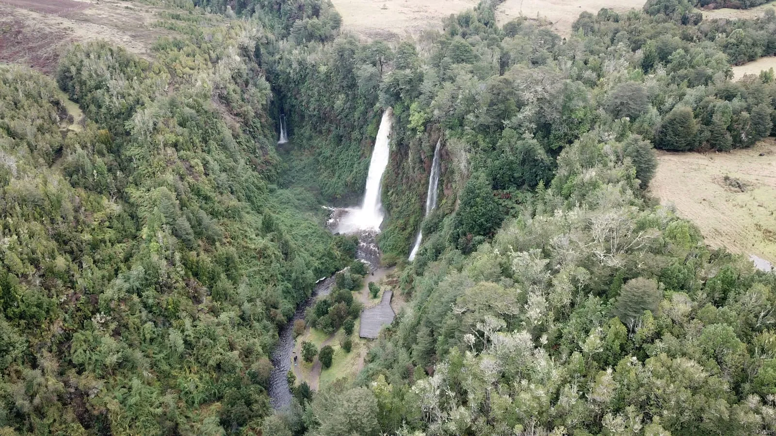
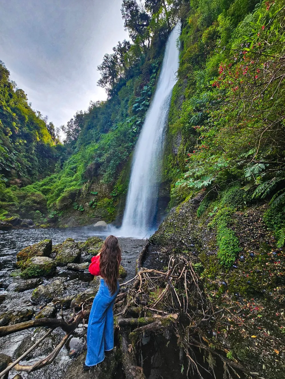
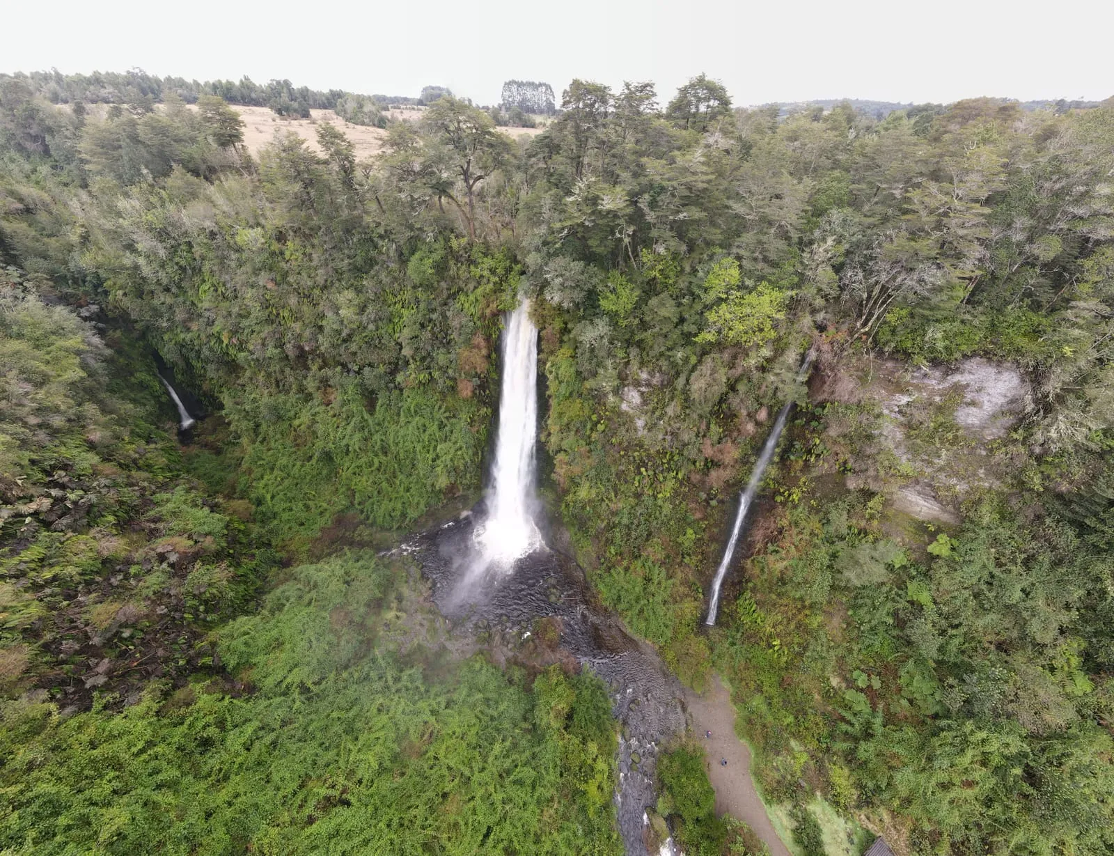
Toponyms like this describe what was in the territory before occupation: the coihue forest around the river is what gave the sector its name. Tocoihue is not a single drop: the Tocoihue river plunges over three falls, with a main drop of up to about 60 m that lands in a circular basin surrounded by evergreen forest. The same sector is also home to a wooden church, an example of the building system that characterises the churches of Chiloé.
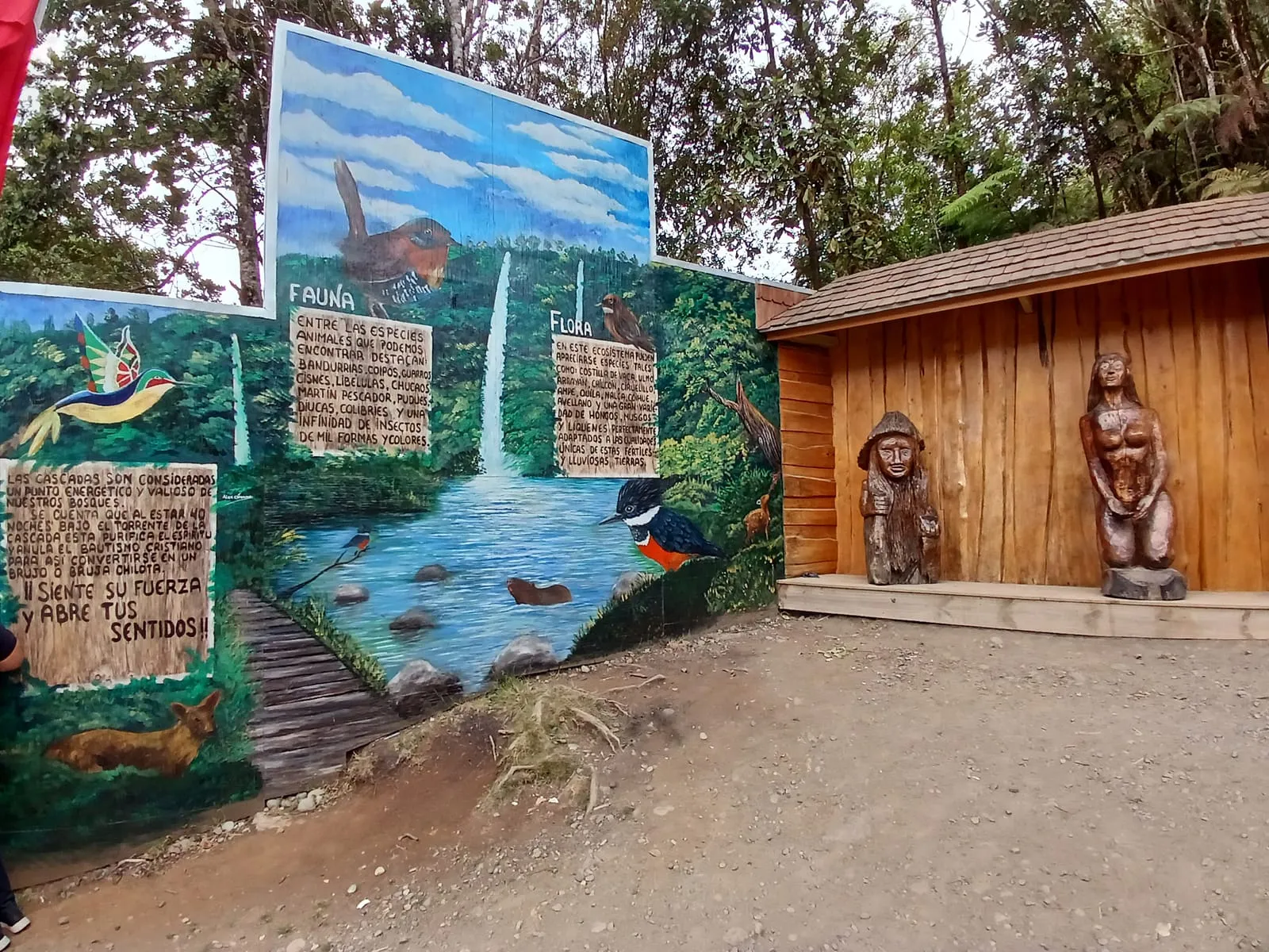
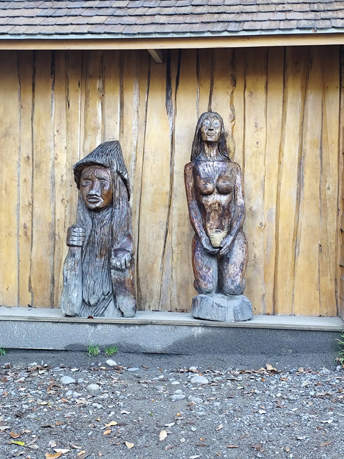
Chiloé is a land of stories, and the one most often told about these falls stars the archipelago’s brujos, or sorcerers: it was said that the curtain of water “erased” Catholic baptism, and that anyone wanting to be rid of it had to stay under the torrent for a long time — twelve hours, a full day, even seven days, depending on the version — until they were clean. That belief overlaps with the Huilliche worldview, in which water is not an inert resource but a newen, a living force, and every waterfall or spring has a ngen, a “keeper” that inhabits it. Water places are therefore treated with respect, permission is asked before entering and silence is kept: the river is territory with an owner.
We present these stories as oral tradition from the area rather than as documented fact: versions differ and none is fixed in writing. To hear the full version, the best approach is to ask local residents or the staff at reception.
This is ancestral Huilliche territory and many of these stories still matter to present-day communities. Take your litter out, do not scratch or mark the rock, do not leave offerings that do not belong to local tradition, and avoid filming or photographing without permission when local people are holding ceremonial activities.
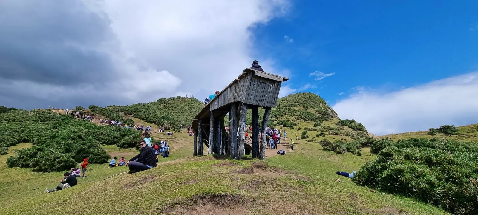
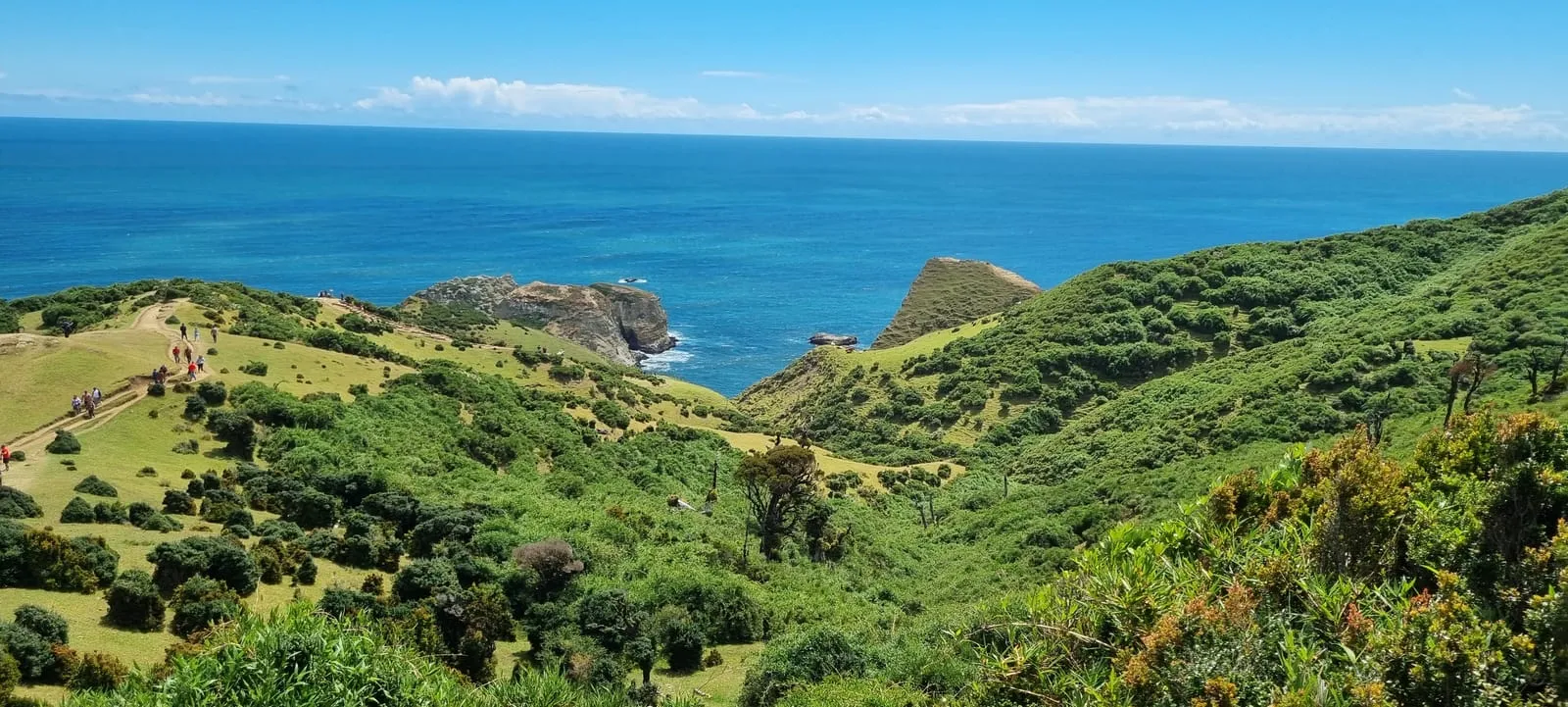
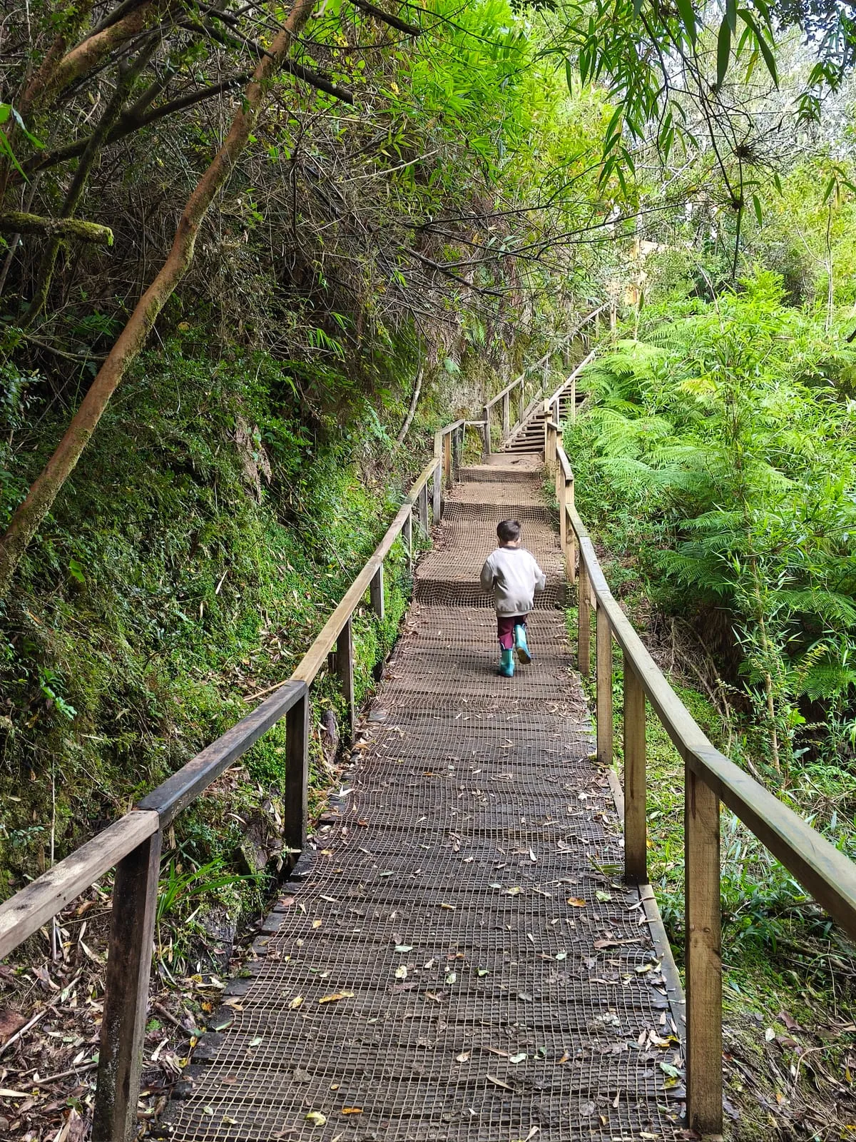
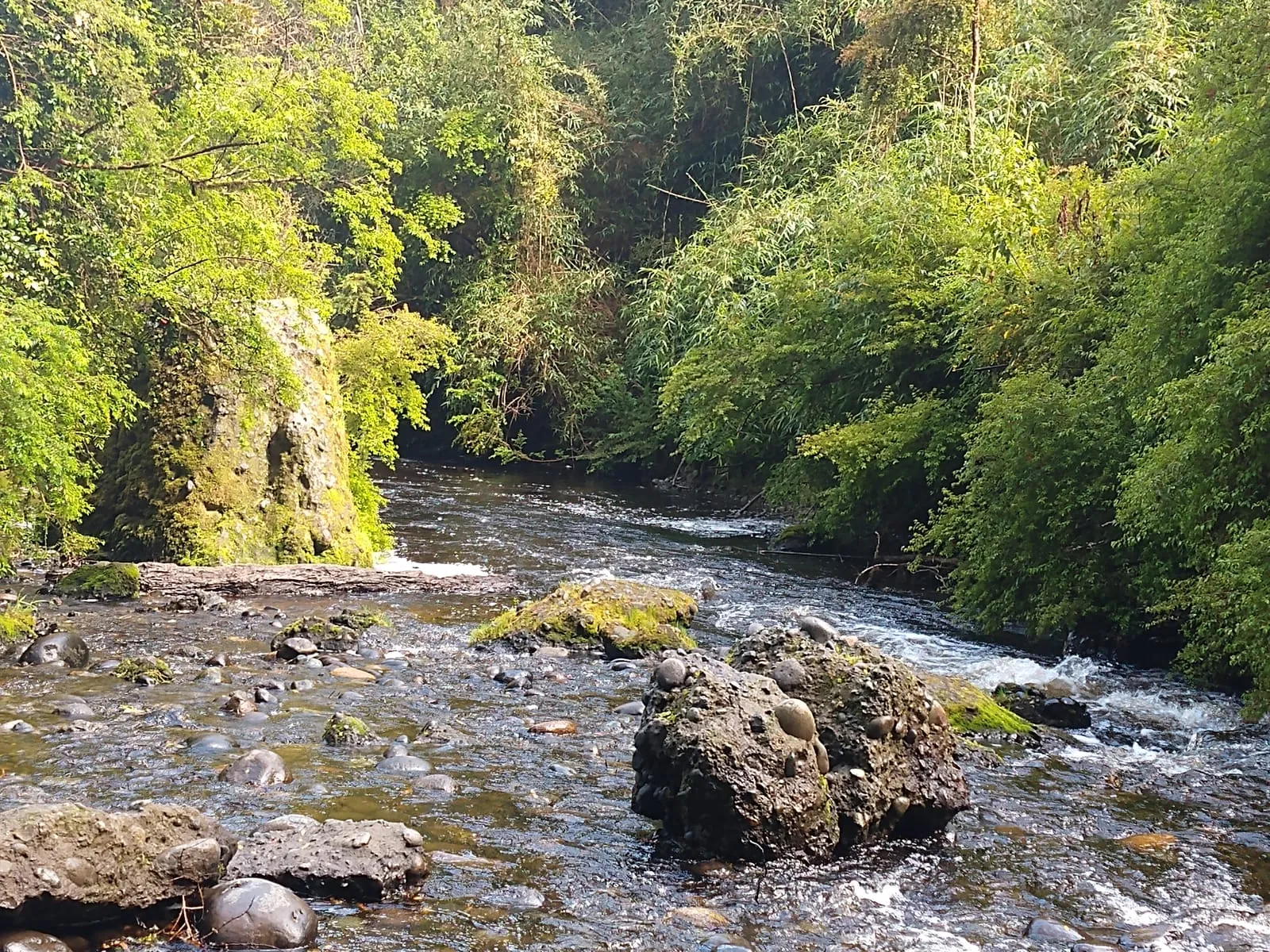
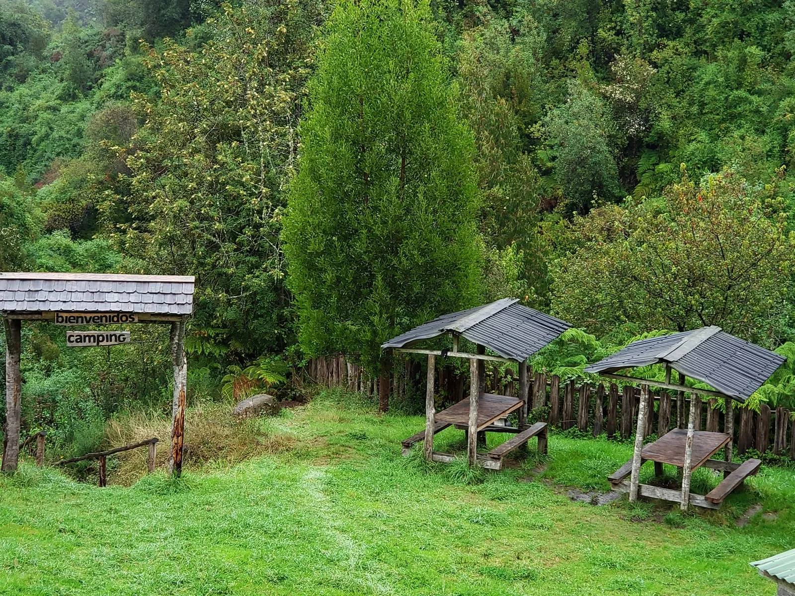
The waterfall and the native forest of Tocoihue, on the Isla Grande de Chiloé
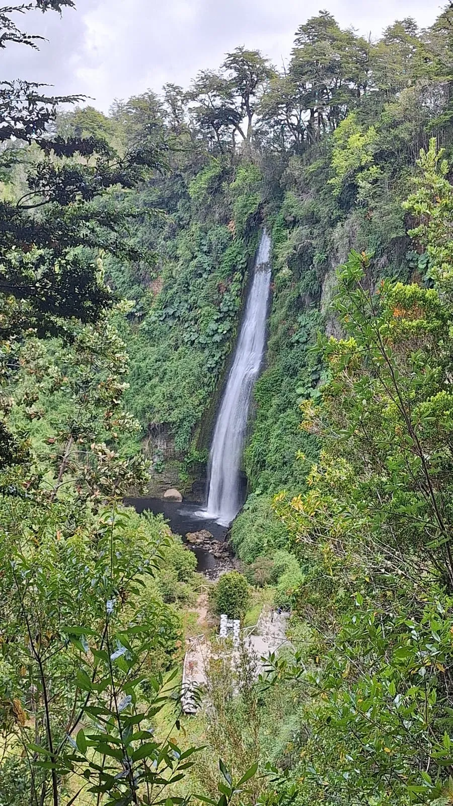
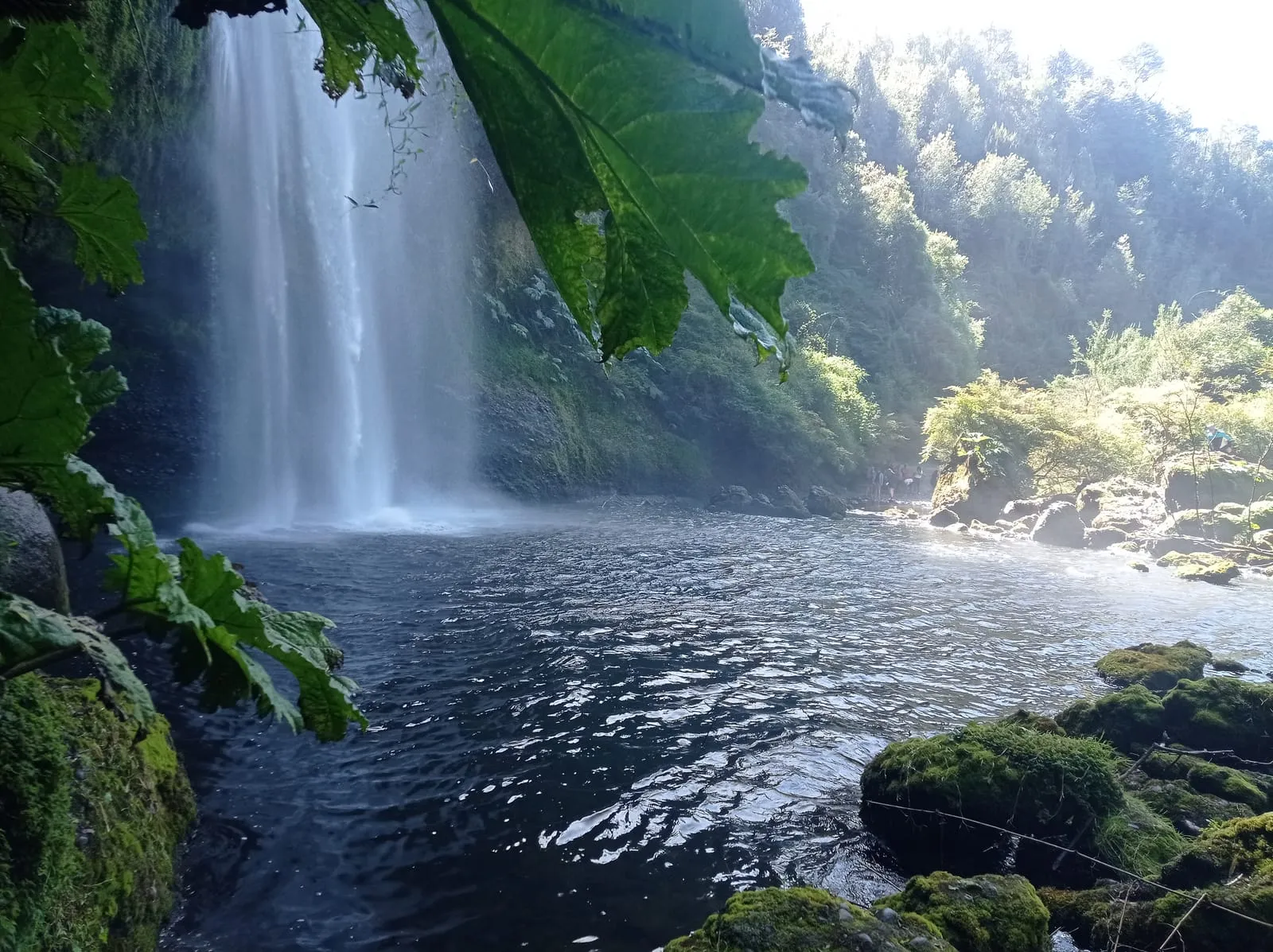
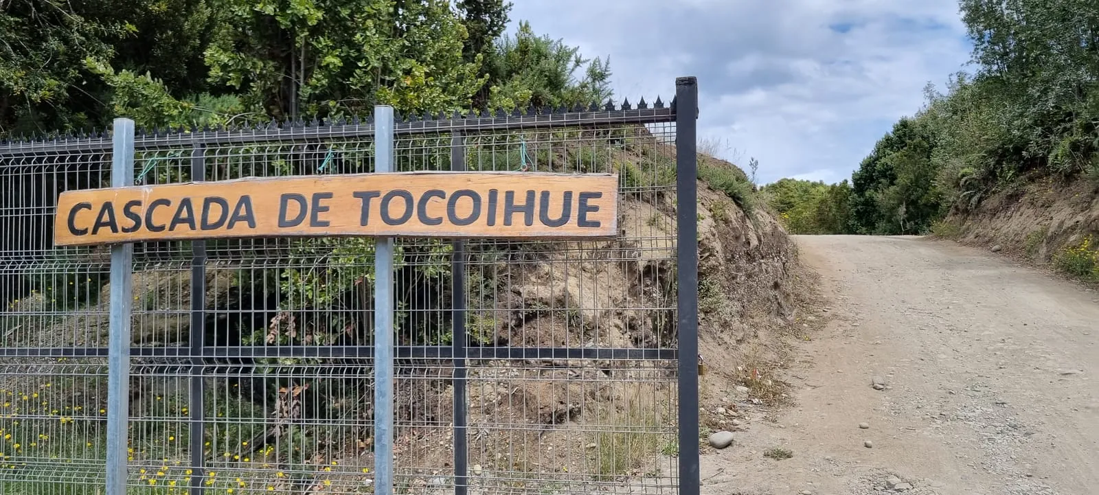
Visitor feedback is available on Google Maps (external link).
"A beautiful, close-by outing. We walked through the native forest to the falls; the water was super clear and the place very well kept. We drove from Dalcahue and it was straightforward."
"Great with kids. The walk is short and the waterfall viewpoint is well worth it. Best to go early, before more people arrive."
A lovely corner of Chiloé. The gravel road was a bit heavy after the rain, but the falls against the forest backdrop are an incredible postcard.
We went on a tour from Castro and they explained the Huilliche history of the place. That added a lot to the visit; I would go back without a doubt.
Practical information on facilities, history and planning your visit to the Cascadas de Tocoihue.
The reserve opens during daylight. In high season (December to March) the usual hours are roughly 10:00 to 20:00, with last entry recommended at least an hour before closing. Outside that season there is no published fixed timetable: closing depends on daylight and the weather. As a private reserve, access can close in heavy rain, strong wind or when the river rises, so confirm on the day by phone or WhatsApp.
From central Dalcahue take the road inland along route U-48 towards the Tocoihue sector and continue for about 20 km. The last kilometres are gravel with no continuous signage: look for the wooden signs marking the entrance, where the parking area is. By car it takes around 30 minutes, longer when the road is wet. For GPS use the coordinates -42.3045792, -73.4376721 or the Plus Code MHW6+5W.
Intercity buses reach Dalcahue or Castro but do not go up to the entrance. From the town you need to combine a transfer, a local taxi or a booked excursion. Bear in mind there are no shops, cash machines or fuel in the rural sector, so sort out fuel, cash and water before you set off.
Spring (September to November) offers the most comfortable balance: more daylight, a trail in better condition and good visibility, with the flow still generous. Summer has the most predictable hours but more visitors and more congestion on the gravel road. In winter the falls are at their most powerful, but there is mud and less daylight. The visit is always on foot along a forest trail, so allow for suitable footwear and time to match your pace.
Yes. The reserve has parking at the entrance, inside the property. There is usually no extra charge for the vehicle beyond the reserve entry, but confirm the amount on arrival, as it can vary by season.
Access is partial. The entrance and reception are fairly flat, but the trail to the viewpoint is dirt and gravel, with slopes and roots, so it is not comfortably suitable for wheelchairs or strollers. Visitors needing reduced access can ask at reception about the day's options.
There are restrooms at the reserve's reception or main house. There is no restaurant along the trail, so bring water and some food; in Dalcahue and Castro you will find cafés, restaurants and shops to stock up before you arrive.
Chiloé is a volcanic island, and the waterfall drops down a wall of basalt rock that the Tocoihue River has shaped over time. The setting is temperate rainforest, with coihue, ulmo, tique and canelo, and an understory of ferns and moss typical of Chiloé's ecoregion.
Tocoihue points to the Huilliche Mapuche root of Chiloé's territory. The river that names the waterfalls rises in the hills of the Dalcahue interior and, for centuries, was part of Huilliche community life long before it became a nature outing.
Because it rises in well-preserved native forest basins, where vegetation filters and retains moisture. Still, after heavy rain the flow rises and the water clouds a little; in spring and summer it is usually at its clearest.
There is an oral tradition rather than a story fixed in writing. The version most often told says the brujos of Chiloé used the falls to “erase” baptism: anyone wanting to be rid of it had to stay under the curtain of water for anywhere from twelve hours to seven days, depending on the version. That belief overlaps with the Huilliche worldview, in which water is a newen — a living force — and every waterfall or spring has a ngen, a “keeper”; that is why water places are treated with respect and permission is asked before entering. Versions vary and there is no canonical one. The same sector is also home to a wooden church, an example of the building system typical of the churches of Chiloé.
Yes. Entry to the reserve has a modest fee paid on arrival, because it is a private conservation property with visitor access. Confirm the exact amount on site or by phone before your visit.
Plan 1.5 to 2.5 hours: park, walk the gravel trail to the viewpoint, enjoy the falls and return. If you add a stop in Dalcahue or Castro, the outing easily fills half a day.
Yes, and with rain the falls are usually fuller and more spectacular. That said, the gravel road gets muddy and the rock can be slippery, so wear proper footwear and avoid the strongest storms, when access may be limited.
Very close is Dalcahue, with its UNESCO heritage church and its famous market of local produce. A bit further, Castro and its stilt houses (palafitos), and the Chiloé National Park for anyone who wants to keep exploring native forest, birds and the island coast.
There are no restaurants and no formal tourist accommodation inside the rural sector of Tocoihue: this is a nature outing and it has no food service of its own. The available options are of the type local eatery, café, bakery, cabin, guesthouse, campsite and hotel, and they are concentrated in Dalcahue and Castro. We describe types of service only: we do not endorse, sponsor or have any agreement with specific businesses.
There are basic toilets at the reserve reception area, but not along the trail or at the viewpoint. The river and stream water is untreated and not safe to drink without purification, so carry water from Dalcahue: allow at least one litre per person.
ATMs are in Dalcahue and Castro, not on the rural road. At nature reserve entrances the fee is usually paid in cash, and the signal needed for card payments can fail. Carry cash in small notes and do not rely on mobile data.
Mobile coverage is partial and intermittent, and it weakens in the forest and ravine sections; there is no public wifi on the trail. Download offline maps before you set out and tell someone your itinerary and expected return time.
Fuel stations are in Dalcahue and Castro. The island’s network of EV chargers is still limited and concentrated in the communal centres, so plan your charging before heading into the rural sector.
In Dalcahue or Castro: mid-sized supermarkets, neighbourhood stores and markets. There are no shops on the rural road, so buy water, snacks and anything else you need before you turn onto the gravel road.
You must ask at the reserve reception. In Chilean nature reserves and conservation areas, pets are commonly restricted or required to be leashed and controlled, for sanitary reasons and to protect wildlife. Do not assume they are allowed.
Chile’s national emergency numbers are 131 (ambulance), 132 (fire brigade), 133 (police) and 134 (investigative police). Because of the distance and the gravel road, response is slow, so give your location using coordinates or the Plus Code MHW6+5W.
This guide brings together public, verifiable information from official bodies, tourism registries and mapping sources, so you can plan your visit with reliable data.
National Tourism Service of Chile
Ilustre Municipalidad de Dalcahue
Ministry of the Environment of Chile
Gobierno Regional de Los Lagos
Sernatur
Open-Meteo
Google Maps
For official updates and regional tourism information, visit Chile's official tourism portal:
Chile / Los Lagos Region Official Tourism Portal ↗All ownership and copyright of the images displayed on this website belong to their original photographers.
Last reviewed: September 2026